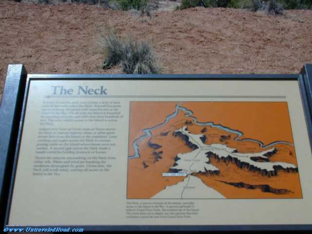
The Neck
In front of you the park road crosses a strip of land
only 40 feet wide called the Neck. Beyond this point
lies an isolated, 43-square-mile mesa known as the
Island in the Sky. On all sides the Island is bounded
by yawning canyons, and cliffs that drop hundreds of
feet. The only vehicle access to the Island is across
the Neck.
Indians may have set brush traps or fences across
the Neck to capture bighorn sheep or other game
driven here from the Island or the mainland. Later,
cowboys put a gate across the Neck to contain
grazing cattle on the Island where fences were not
needed. A second gate across the Neck made a
handy corral for holding livestock or horses.
Notice the canyons encroaching on the Neck from
either side. Water and wind are breaking the
sandstone down grain by grain. Given time, the
Neck will erode away, cutting off access to the
Island in the Sky.
The Neck, a narrow remnant of the plateau, provides
access to the Island in the Sky. A paved road leads 11
miles to Grand View Point, the southern tip of the Island.
The rivers have cut so deeply into the canyons that their
confluence cannot be seen from Grand View Point.

Don't miss the rest of our virtual tour of Canyonlands National Park in 1804 images.